
Contact us at the Consulting WP office nearest to you or submit a business inquiry online.
-
Earth Observation Data Analytics
- April 7, 2026
- Posted by: Admin
- Categories:
No Comments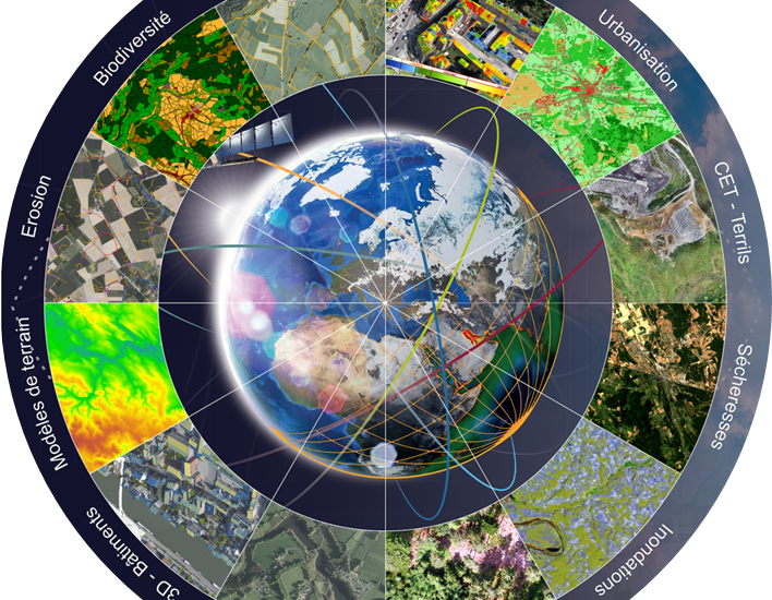
We utilise Earth observation data and remote sensing data analysis to monitor, analyze, and map physical, chemical, and biological characteristics of the Earth. Key services include automated image processing via AI/ML, environmental monitoring (carbon, forests, water), and near real-time alerts for events like floods
-
Measured Building Surveys
- February 13, 2026
- Posted by: Admin
- Categories:
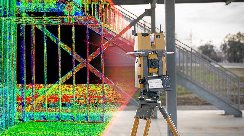
Using tools like 3D terrestrial laser scanners, mobile scanners, muti total stations, and drones we undertake surveys produce 2D plans, elevations, sections, and 3D models crucial for architectural, renovation, and construction projects.
-
GIS Services
- January 14, 2016
- Posted by: Admin
- Categories:

We provide expert consulting, development, and data management to help organizations implement, optimize, and leverage GIS for spatial analysis and decision-making. Our services include Mapping, Spatial analysis, custom software development, database modelling, cloud solutions, and training.
-
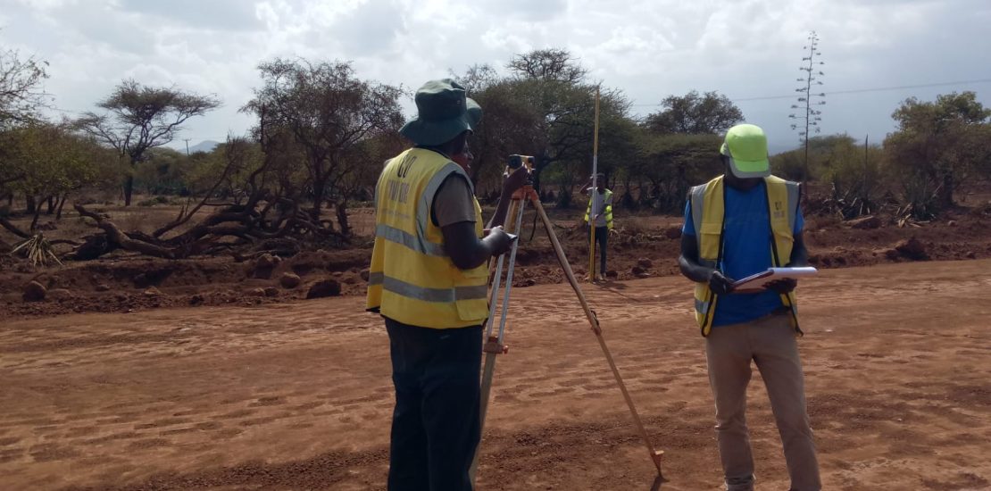
Topographical Surveys
- January 14, 2016
- Posted by: Admin
- Categories:
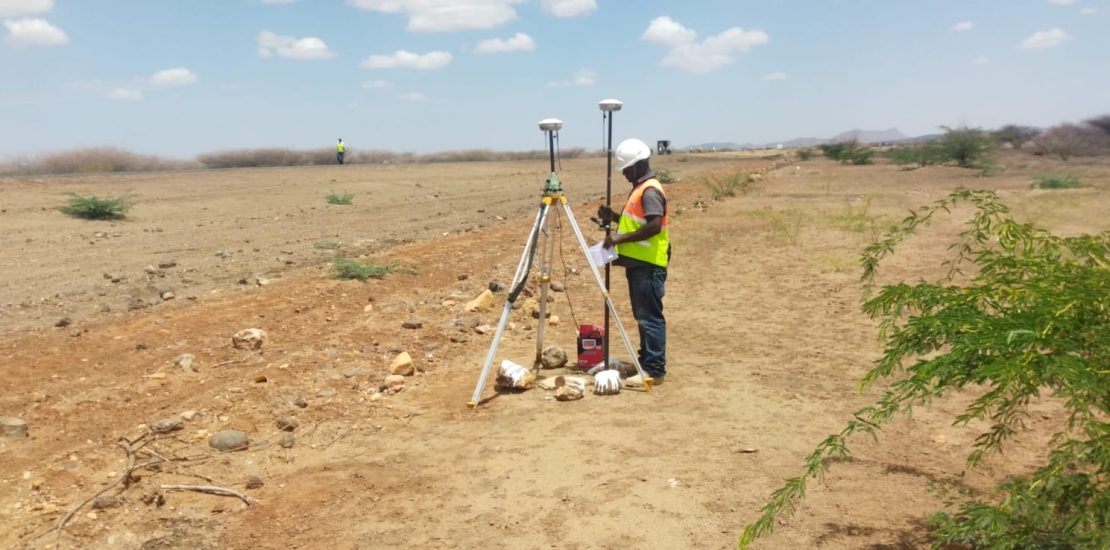
We deliver highly accurate topographical surveys that support feasibility studies, planning, construction, and land development projects. Our topographic surveys are relied upon by architects, engineers, developers, and landowners across Africa.
-
Drone Services
- January 14, 2016
- Posted by: Admin
- Categories:
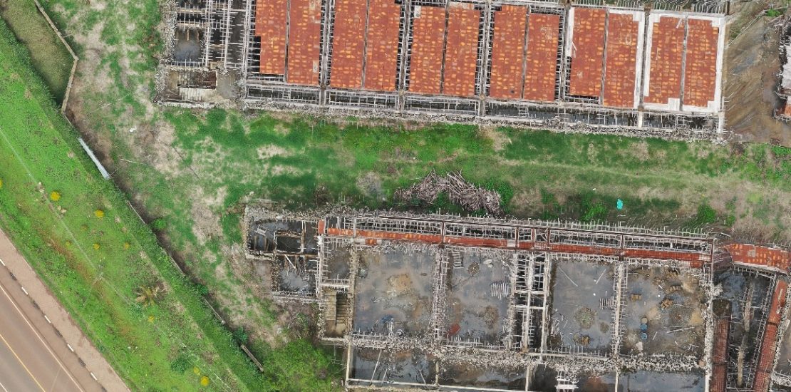
We provide Licensed certified drone services covering drone based construction management, Powerline & Environmental Monitoring, infrastructure and asset inspections, drone aerial mapping & photogrammetry. We deploy survey grade drone that capture accurate data and delivered aerial orthomosaic,3D models, point clouds for wide range of applications.
-
CAD & 3D Modelling
- January 14, 2016
- Posted by: Admin
- Categories:
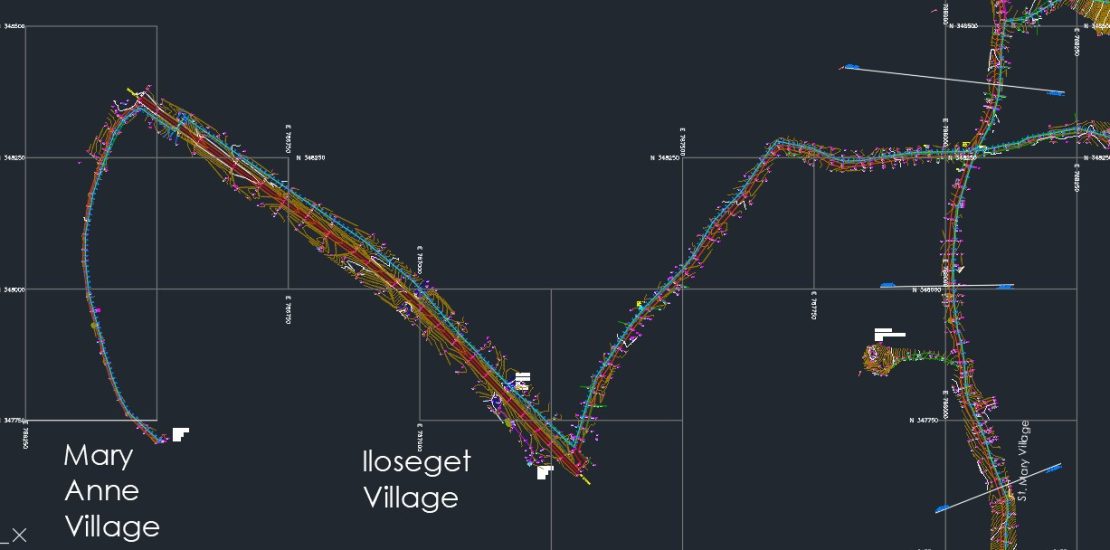
We provide CAD services that include AutoCAD Civil 3D, 2D drafting and 3D modelling tailored for civil engineering and infrastructure projects. Our services support you seamlessly integrates data enabling engineering-architectural and construction projects to create, visualize, analyze, and document AEC projects designs with precision.
-
Site Engineering & Construction Survey
- January 14, 2016
- Posted by: Admin
- Categories:
We provide specialist survey support during the construction stage of any size of project. Our Engineering & Construction surveys services supports excavation, piling, earthwork, groundwork and foundations, ensuring construction proceeds with high level of accuracy.
