Construction & Engineering Surveying

Home Civil-Construction & Engineering Survey

Construction & Site Engineering Surveyors.

We provide professional surveying services that support the AEC sectors with outputs key for feasibility studies,detailed designs,reviews for construction projects, right-of-way developments, road infrastructure development, sewerage and drainage systems and support housing and land development projects.


Metricon continue to think outside the box, innovate  and adopt latest dynamic technologies and engineering survey data collection and  processing innovations to provide accurate data for infrastructure design and development.

Engineering survey project leadership — Major projects are organizations in themselves. While they are only temporary, they still need the same set of core leadership competencies.We deploys strategic vision and effective communication that help maintain strength of focus, direction, and motivation over the length of a major project.

Cross professional project teams– We have gained experience through various projects where we properly and effectively engage, manage and  integrate all projects stakeholders ensuring seamless project implementation.

Technical skills and experience– Metricon adopts a holistic approach while undertaking our engineering survey tasks, we have skilled and technical conversant engineering survey teams.We have requisite Land and engineering survey projects management, project controls and technology experience  key in successfully delivering on  major projects.
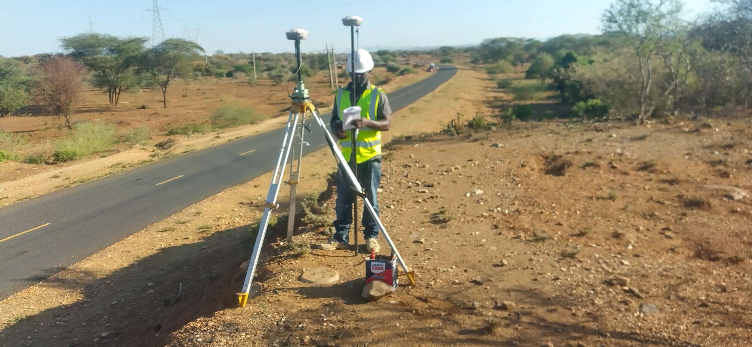
SURVEYING

At Metricon, we employ advanced engineering survey  instruments to achieve the high precision necessary for the setting out of various engineering works. This covers wide range of  projects like pipelines, highways, bridges, and underground constructions for tunnels and mining..


We offer expertise and speed in executing our projects, ensuring that your engineering surveys are conducted efficiently and effectively, minimising downtime while maximising accuracy and reliability.


We continuously scale our technology and innovation  in surveying instrumentation , software and project management expertise to offer services beyond traditional site engineering survey works.

SURVEYING SERVICES

We provide professional and demand responsive engineering surveying services for projects covering  Land development, engineering site constructions works, building constructions, corridor infrastructure , route utility planning and design,mining services, offshore constructions, water storage system constructions and specialist surveying services that serves all infrastructure development needs.

Control surveys are undertaken to provide the horizontal and vertical positions of points and form the basis of most surveying projects. These controls provide the standard of accuracy for any subsequent surveys. Control surveys include;

  • GPS / GNSS control surveys
  • Trigonometric
  • Photogrammetric Aerial mapping Control Survey
  • High precision digital levelling

DETAILED TOPOGRAPHICAL SURVEYS

Whether it is a new infrastructure project,  extensions of exiting Architectural-Engineering or Construction projects (AEC) to a proposed infrastructure rehabilitations, water supply projects, renewable energy installations or  greenfield subdivision a Detail Survey (also known as a Topographic Survey or Contour Survey) is often the first step in any development.

A Detail topographical Survey establishes the site boundaries, investigates any easements, restrictions or encumbrances on the project area, locates existing features on the site and on adjoining sites and determines horizontal positions and and elevations  . These determined levels are then used to create a Digital Terrain Model (DTM) and contours.

  •  

Before  commencement of  construction of  new buildings, roads,railway, water supply projects, dams, or any erected on earth  surface the services of a surveyor is crucial to mark the positions of the proposed works. Most construction setting -out will involve;

  • Pre-calculation of the works to be set out based on your architectural, civil-structural  drawings, QA checks to ensure all the required information is included and that the approved boundary extents are integrated;

  • Determination of the site boundary positions;

  • Placement of setting out marks at design positions as discussed with project construction and works supervision team;

  • Placement of site benchmarks for control of extent of excavations depths, earthworks and quantities;

  • Preparation of a sketch showing the marks placed endorsed by a Registered Surveyor.


Metricon is experienced and understands infrastructure design-build and maintenance project phase and provide services for site  construction surveys key to meet project objectives.Checks of the designs are conducted in several ways, starting with pre-calculations to ensure field data is fit for purpose and extends to the set-out and measuring on-site. All set-out accuracies are driven by project specifications and are backed up by rigorous field checks.

As-Built Surveys

These  typically takes place during or near the end of the project or before start of renovation works for existing structures,plants and installations. Our field comes  onto the construction site to survey record existing conditions and verify that the building or structures are laid out consistently with the architectural or engineering drawings.

These survey would note the location of boundaries, location of existing utilities, elevations and positions of key features on the property, and verify the details against designs for post-construction audits and maintenance.

Metricon use the latest survey equipments including 3D laser scanners (LiDAR), Unmanned Aerial Vehicle(UAV) and mobile scanners that capture massive data as point cloud. We have experienced technicians who process site data to using various software applications delivering point cloud files, 3D renderings or drawings based on your CAD or BIM documentation needs.

Areas where as-built-survey and documentation are key include:

  • Real Estate projects
  • Commercial Properties construction and renovations
  • Residential Constructions and renovations
  • Asset capture and documentation
  • Infrastructure as built drawings

Ground Penetration Radar / Ground Probing Radar (GPR) technology surveys are adopted to locate objects  of  different materials lying below ground environments within a project location. These surveys help point-point precise siting which is key in infrastructure projects that affects various service lines e.g water  systems, powerline cabling. These surveys are  useful for finding the location of objects buried underground, which would otherwise be invisible in post-construction stages.

GPR surveys are useful to detect and map the following;

  • Fibre optic cables
  • Plastic gas pipes  
  • Concrete pipes
  • Plastic water pipes
  • Plastic cable ducts
  • Plastic fuel pipes
  • Plastic vent pipes


GPS/GIS Survey of Subsurface Utilities

GIS Mapping and data processing is crucial in developing standardised digital data formats for utility maps which can be shared across  CAD and GIS environments for pre construction stages, construction phases  and  maintenance periods.

Metricon adopts GNSS technology to accurately map the exact position of underground utilities anywhere. Having a record of the exact location of subsurface infrastructure is critical for construction planning , utility maintenance and management.

Where we offer our services

Metricon has the capabilities and experience to efficiently service earthworks projects of all sizes.

Survey task includes:

  • RTK GPS/GNSS surveys
  • Stockpile pickups
  • Volume calculations
  • Drill and blast pattern surveys
  • Machine control
  • Formation surveys
  • Clearing surveys
  • Topographical surveys
  • Road construction

Metricon Surveying team owns  latest total stations, GNSS , terrestrial scanners and  associated technologies to increase productivity and reduce costs.

This include high accuracy set out surveys as per construction drawings and models for concrete structures and infrastructure installation.Surveys are also undertaken  during works conformance and as-builts (pre-pours and post-pours) and bolt layout.

A commercial land survey is an indispensable in real estate, serving as the bedrock for informed decision-making, risk mitigation, and strategic planning. Whether you are buying, selling, developing, or managing commercial property, understanding the precise boundaries, topography, and legal constraints of your land is crucial.

Our  survey services provides detailed  land’s topography, identifying any potential challenges  that may impact the project. ranging from elevation changes, the location of utilities, existence of  easements or right-of-ways that must be considered during the planning stages.

Companies installing piles, anchor bolts and other critical support structures within industrial facilities, pipe racks, bridges or residential and commercial buildings, There is need to survey your construction site for the precise design location of piles and anchor bolts to ensure your projects’ success.

Laying out gridlines provides the framework upon which all other design elements are referenced. This  layout supports contractors  for their own construction and position within the site.

Request for a quotation

Request for a quotation


Name
Name

First

Last